

In a recent blog article on Mt St Helen’s 31st anniversary, I discussed a visit to the Mt St Helens National Volcanic Monument and displayed some images of earlier 2006 volcanic steam activity.
Today, in 2011, Mt St Helens today is relatively peaceful. The U.S.G.S. Cascade Volcano Observatory has assigned it a “normal” rating (since July 2008) reflecting its relative quiet. The explosive eruption (and buildup) of May 18, 1980 is far behind us, and the volcano has left some distance between the eruptions of 2004-8 and today. The image shows clouds dancing across the crater, not steam of volcanic origin.
Indications are that Mt St Helens will continue its eruptive activity and is likely to erupt again in this century. (Mt St Helens - A 30 Year Legacy of Volcansim - EOS-AGU). This is based on its age and past history.
In my last article, “Calculating Odds and Probabilities” I discussed the assessment of various odds and probabilities ranging from coin tosses to weather forecasting. It is clear that some predictions are relatively straightforward and others are incredibly complex.
The events, risks and probabilities associated with volcanic hazards present a great challenge because of the wide ranging risks, the variability of impacts and the low probabilities of occurrence associated with very high impact events.
Mt St Helens showed us in 1980 that a low probability, high impact event can happen in our lifetime and region (Washington State). While Mt St Helens is the most active of Cascade Volcanoes, the other Cascade Volcanoes are also of interest.
The USGS provides an interactive map of the Cascade Volcanoes from Washington to Northern California. The summary provides a broad overview picturing the scope of Cascade Volcanoes throughout the region. The map/page provides links to each of the Cascade Volcano “Visit a Volcano Site” providing a photo and information for each volcano.
The difficulty in assessing the risk associated with an event, whether it is meteorological or seismic, is in assessing the probability that it will occur, the severity of the event should it occur, and the impact on the population.
The USGS has done a great deal of work in identifying hazards for the Cascade volcanoes. The Mount St Helens eruption, and other volcanic eruptions have allowed geologists to gain a great deal of information regarding volcanic hazards, and develop advanced monitoring technologies to allow them to better manage volcanic risk.
A USGS Fact Sheet (What are Volcano Hazards?) describes Volcano hazards, both in text and with a graphic that displays the hazards on a simplified Cascade volcano.
The hazards shown in the Fact Sheet include hazards that we saw with the 1980 Mt St Helens eruption. The pyroclastic flow that blasted down numerous trees, scorched others and killed people. The towering ash cloud that rained ash fall on Eastern Washington and continued around the world. The debris flows that sculptured the landscape in destructive lahars , racing down the Toutle River, washing out bridges and silting up the Columbia River.
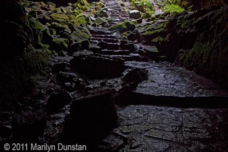
In addition, we see the impact of much earlier lava flows in Mt St Helen’s Ape Cave Lava Tube. Ape Cave contains the continental United States’ longest continuous lava tube, occurring around 2,000 years ago in the Cave Basalt.
Cascade volcanoes have an extensive volcanic history, as displayed in a display of their eruptive history over the past 4,000 years which is available as a pdf or poster to order from USGS.
We can look at the chart of volcanic history and wonder given the frequency and time since last eruption, whether a particular mountain is “due” for an eruption. We do know that future eruptions may occur, we simply may not know when. Once volcanic activity has started, geologists are better able to monitor and respond to the ongoing situation.
It is a matter of living with uncertainty and managing risks.
The USGS has comprehensive risk assessments for each Cascade Volcano. More information can be obtained through the USGS’s Cascade Volcano Observatory Website.